
Abade topographic map
Interactive map
Click on the map to display elevation.
About this map
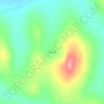
Name: Abade topographic map, elevation, terrain.
Location: Abade, Apac, Northern Region, Uganda (1.74742 32.22815 1.78742 32.26815)
Average elevation: 1,072 m
Minimum elevation: 1,033 m
Maximum elevation: 1,142 m
Other topographic maps
Click on a map to view its topography, its elevation and its terrain.