Geolocate

Exbourne topographic map

Click on the map to display elevation.

About this map

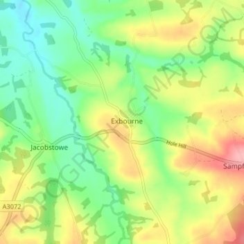
Name: Exbourne topographic map, elevation, terrain.

Location: Exbourne, West Devon, Devon, England, United Kingdom (50.77988 -4.01353 50.82120 -3.96347)

Average elevation: 117 m

Minimum elevation: 73 m

Maximum elevation: 180 m

Devon trails, hiking, mountain biking, running and outdoor activities

Gear up for your next adventure:

🗺️Ordnance Survey Maps - Official UK maps for walking and outdoor activities
🍱Food Containers - Reusable containers for outdoor meals
🎒Hiking Daypacks - Compact backpacks ideal for short hikes and excursions
👟Women's Trail Running Shoes - Agile footwear for fell running and technical trails
🥤Hydration Bladders - Hands-free hydration systems for backpacks

As an Amazon Associate, this site earns from qualifying purchases at no extra cost to you.