
Milton topographic map
Click on the map to display elevation.
About this map
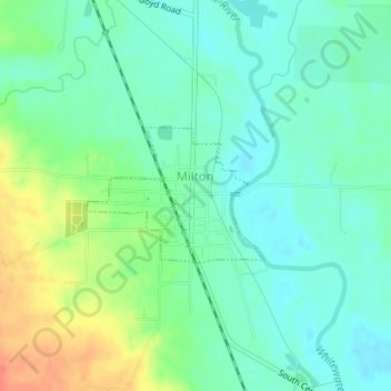
Name: Milton topographic map, elevation, terrain.
Location: Milton, Wayne County, Indiana, United States (39.78211 -85.16493 39.79149 -85.14896)
Average elevation: 289 m
Minimum elevation: 271 m
Maximum elevation: 327 m
Other topographic maps
Click on a map to view its topography, its elevation and its terrain.
Hoosier Hill
United States > Indiana > Wayne County
Hoosier Hill is the highest natural point in the U.S. state of Indiana with a claimed elevation of 1,257 feet (383 meters) above sea level. Hoosier Hill's claimed elevation is based on SRTM digital elevation data which is now considered to be outdated. Using newer elevation tools such as USGS's 3DEP, the top…
Average elevation: 373 m