
Jahrom City topographic map
Interactive map
Click on the map to display elevation.
About this map
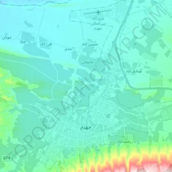
Name: Jahrom City topographic map, elevation, terrain.
Location: Jahrom City, بخش مرکزی, شهرستان جهرم, Fars Province, Iran (28.46784 53.52511 28.59546 53.65409)
Average elevation: 1,090 m
Minimum elevation: 985 m
Maximum elevation: 1,842 m
Other topographic maps
Click on a map to view its topography, its elevation and its terrain.