
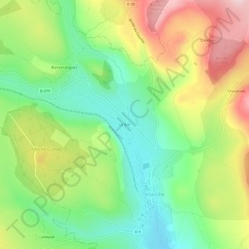
Le Bac topographic map
Interactive map
Click on the map to display elevation.
About this map
Name: Le Bac topographic map, elevation, terrain.
Average elevation: 1,080 m
Minimum elevation: 959 m
Maximum elevation: 1,250 m
Other topographic maps
Click on a map to view its topography, its elevation and its terrain.
Maillargues
France > Auvergne-Rhône-Alpes > Cantal > Allanche
Maillargues, Allanche, Saint-Flour, Cantal, Auvergne-Rhône-Alpes, France métropolitaine, 15160, France
Average elevation: 1,058 m
Le Landeyrat
France > Auvergne-Rhône-Alpes > Cantal > Allanche
Le Landeyrat, Allanche, Saint-Flour, Cantal, Auvergne-Rhône-Alpes, France métropolitaine, 15160, France
Average elevation: 1,067 m
Chavanon
France > Auvergne-Rhône-Alpes > Cantal > Allanche
Chavanon, Allanche, Saint-Flour, Cantal, Auvergne-Rhône-Alpes, France métropolitaine, 15160, France
Average elevation: 1,157 m