
Wabag District topographic map
Interactive map
Click on the map to display elevation.
About this map
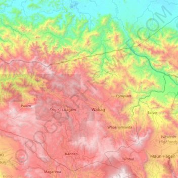
Name: Wabag District topographic map, elevation, terrain.
Location: Wabag District, Enga, Highlands Region, Papua New Guinea (-6.03333 142.95000 -4.63333 144.35000)
Average elevation: 1,680 m
Minimum elevation: 6 m
Maximum elevation: 4,020 m
Other topographic maps
Click on a map to view its topography, its elevation and its terrain.