
Alcanede topographic map
Interactive map
Click on the map to display elevation.
About this map
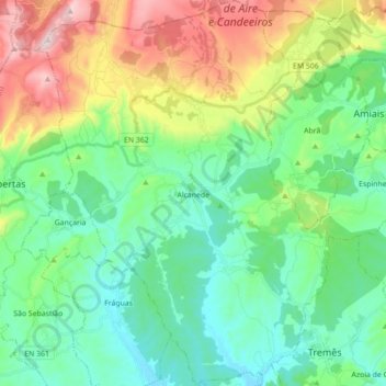
Name: Alcanede topographic map, elevation, terrain.
Location: Alcanede, Santarém, Portugal (39.34736 -8.89257 39.48301 -8.75887)
Average elevation: 173 m
Minimum elevation: 29 m
Maximum elevation: 523 m
Other topographic maps
Click on a map to view its topography, its elevation and its terrain.