
La Gallerie topographic map
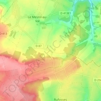
Interactive map
Click on the map to display elevation.
About this map
Name: La Gallerie topographic map, elevation, terrain.
Average elevation: 129 m
Minimum elevation: 72 m
Maximum elevation: 180 m
Other topographic maps
Click on a map to view its topography, its elevation and its terrain.
La Galle
France > Normandie > Manche > Le Mesnil-au-Val
La Galle, Le Mesnil-au-Val, Cherbourg, Manche, Normandie, France métropolitaine, 50110, France
Average elevation: 130 m
Le Hameau Paris
France > Normandie > Manche > Le Mesnil-au-Val
Le Hameau Paris, Le Mesnil-au-Val, Cherbourg, Manche, Normandie, France métropolitaine, 50110, France
Average elevation: 125 m