
Langnau topographic map
Interactive map
Click on the map to display elevation.
About this map
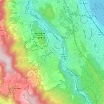
Name: Langnau topographic map, elevation, terrain.
Location: Langnau, Bezirk Horgen, Zürich, 8135, Schweiz (47.26766 8.51728 47.30766 8.55728)
Average elevation: 586 m
Minimum elevation: 401 m
Maximum elevation: 890 m