
Chuka topographic map
Interactive map
Click on the map to display elevation.
About this map
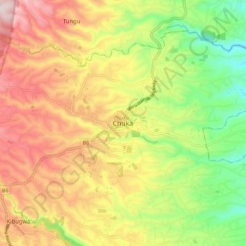
Name: Chuka topographic map, elevation, terrain.
Location: Chuka, Tharaka-Nithi, East Kenya, Kenya (-0.37329 37.61000 -0.29329 37.69000)
Average elevation: 1,400 m
Minimum elevation: 1,179 m
Maximum elevation: 1,624 m