
Thank you for supporting this site ❤️
Make a donation
Make a donation
Gear up for your next adventure:
As an Amazon Associate, this site earns from qualifying purchases at no extra cost to you.
Harike topographic map
Click on the map to display elevation.
Thank you for supporting this site ❤️
Make a donation
Make a donation
Gear up for your next adventure:
As an Amazon Associate, this site earns from qualifying purchases at no extra cost to you.
About this map
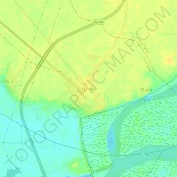
Name: Harike topographic map, elevation, terrain.
Location: Harike, Patti Tahsil, Tarn Taran, Punjab, 143412, India (31.14748 74.92486 31.18748 74.96486)
Average elevation: 215 m
Minimum elevation: 203 m
Maximum elevation: 225 m
Thank you for supporting this site ❤️
Make a donation
Make a donation
Gear up for your next adventure:
As an Amazon Associate, this site earns from qualifying purchases at no extra cost to you.