
Thank you for supporting this site ❤️
Make a donation
Make a donation
Gear up for your next adventure:
As an Amazon Associate, this site earns from qualifying purchases at no extra cost to you.
Sarudu topographic map
Click on the map to display elevation.
Thank you for supporting this site ❤️
Make a donation
Make a donation
Gear up for your next adventure:
As an Amazon Associate, this site earns from qualifying purchases at no extra cost to you.
About this map
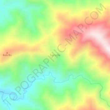
Name: Sarudu topographic map, elevation, terrain.
Location: Sarudu, Pasangkayu, West Sulawesi, Sulawesi, Indonesia (-1.69605 119.52926 -1.65605 119.56926)
Average elevation: 473 m
Minimum elevation: 137 m
Maximum elevation: 918 m
Thank you for supporting this site ❤️
Make a donation
Make a donation
Gear up for your next adventure:
As an Amazon Associate, this site earns from qualifying purchases at no extra cost to you.