
Texanna topographic map
Interactive map
Click on the map to display elevation.
About this map
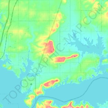
Name: Texanna topographic map, elevation, terrain.
Location: Texanna, McIntosh County, Oklahoma, États-Unis d'Amérique (35.28447 -95.57805 35.43502 -95.42454)
Average elevation: 196 m
Minimum elevation: 176 m
Maximum elevation: 281 m