Geolocate

Georgetown topographic map

Click on the map to display elevation.

About this map

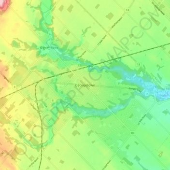
Name: Georgetown topographic map, elevation, terrain.

Location: Georgetown, Halton Hills, Halton Region, Golden Horseshoe, Ontario, L7G 4T3, Canada (43.61027 -79.94361 43.69027 -79.86361)

Average elevation: 255 m

Minimum elevation: 195 m

Maximum elevation: 350 m

Other topographic maps

Click on a map to view its topography, its elevation and its terrain.

Gear up for your next adventure:

📱Phone Mounts for Hiking - Secure mounts to carry your phone on trails
🥾Trekking Poles - Poles to improve stability on uneven terrain
📸Action Camera Chest Mounts - Record your ascent following topographic paths hands-free
🍱Food Containers - Reusable containers for outdoor meals
🥾Women's Waterproof Hiking Boots - High-performance trekking boots designed for all-weather comfort

As an Amazon Associate, this site earns from qualifying purchases at no extra cost to you.