
Sedrata District topographic map
Interactive map
Click on the map to display elevation.
About this map
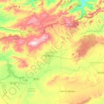
Name: Sedrata District topographic map, elevation, terrain.
Location: Sedrata District, Souk Ahras, 41200, Algeria (36.05801 7.28161 36.23535 7.66974)
Average elevation: 906 m
Minimum elevation: 475 m
Maximum elevation: 1,419 m
Other topographic maps
Click on a map to view its topography, its elevation and its terrain.
Khemissa
Algeria > Souk Ahras > Sedrata District > Khemissa
Khemissa, Sedrata District, Souk Ahras, Algeria
Average elevation: 956 m