
Wengle topographic map
Interactive map
Click on the map to display elevation.
About this map
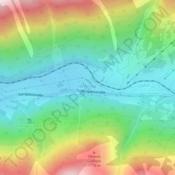
Name: Wengle topographic map, elevation, terrain.
Location: Wengle, Bezirk Reutte, Tirol, Österreich (47.41839 10.81934 47.41957 10.82552)
Average elevation: 1,350 m
Minimum elevation: 1,074 m
Maximum elevation: 1,877 m