
Le Grand Village topographic map
Interactive map
Click on the map to display elevation.
About this map
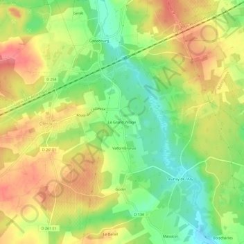
Name: Le Grand Village topographic map, elevation, terrain.
Average elevation: 65 m
Minimum elevation: 28 m
Maximum elevation: 100 m
Other topographic maps
Click on a map to view its topography, its elevation and its terrain.
Genêt
France > Nouvelle-Aquitaine > Charente-Maritime > Clérac
Genêt, Clérac, Jonzac, Charente-Maritime, Nouvelle-Aquitaine, France métropolitaine, 17270, France
Average elevation: 72 m