
Parângul Mare topographic map
Interactive map
Click on the map to display elevation.
About this map
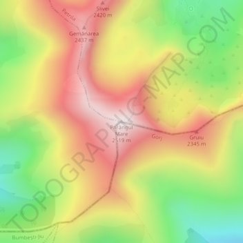
Name: Parângul Mare topographic map, elevation, terrain.
Location: Parângul Mare, Petrila, Hunedoara, Romania (45.34011 23.53926 45.34021 23.53936)
Average elevation: 2,138 m
Minimum elevation: 1,726 m
Maximum elevation: 2,512 m