Geolocate

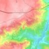
Valverde topographic map

Click on the map to display elevation.

About this map

Name: Valverde topographic map, elevation, terrain.

Location: Valverde, Almeida, Guarda, Portugal (40.68192 -7.00827 40.74105 -6.93353)

Average elevation: 653 m

Minimum elevation: 496 m

Maximum elevation: 739 m

Other topographic maps

Click on a map to view its topography, its elevation and its terrain.
Castelo Mendo

Portugal > Guarda > Almeida

Average elevation: 722 m

Jardo

Portugal > Guarda > Almeida

Average elevation: 721 m

Peva

Portugal > Guarda > Almeida

Average elevation: 705 m

Pailobo

Portugal > Guarda > Almeida > Pailobo

Average elevation: 773 m

Castelo Mendo

Portugal > Guarda > Almeida

Average elevation: 722 m

Gear up for your next adventure:

🛰️Handheld GPS Devices - Reliable GPS units for hiking and outdoor navigation
🕶️Glacier Goggles - Maximum protection for high-altitude snow topography
🧵Survival Paracord - Multi-purpose cordage for emergency repairs and shelters
👟Women's Trail Running Shoes - Agile footwear for fell running and technical trails
🧰First Aid Kits - Essential safety kits for outdoor activities

As an Amazon Associate, this site earns from qualifying purchases at no extra cost to you.