
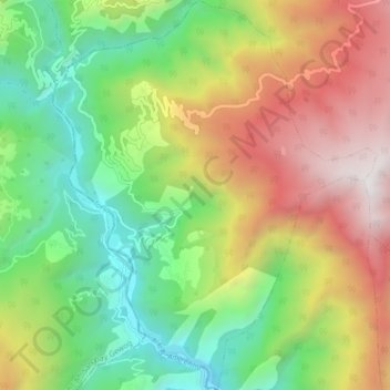
Dorithasa_Kowkha_Yangtse topographic map
Interactive map
Click on the map to display elevation.
About this map
Name: Dorithasa_Kowkha_Yangtse topographic map, elevation, terrain.
Location: Dorithasa_Kowkha_Yangtse, Gakiling Gewog, Haa District, Bhutan (27.09242 89.12983 27.16891 89.20122)
Average elevation: 1,731 m
Minimum elevation: 687 m
Maximum elevation: 3,220 m