
Thank you for supporting this site ❤️
Make a donation
Make a donation
Gear up for your next adventure:
As an Amazon Associate, this site earns from qualifying purchases at no extra cost to you.
Málkov topographic map
Click on the map to display elevation.
Thank you for supporting this site ❤️
Make a donation
Make a donation
Gear up for your next adventure:
As an Amazon Associate, this site earns from qualifying purchases at no extra cost to you.
About this map
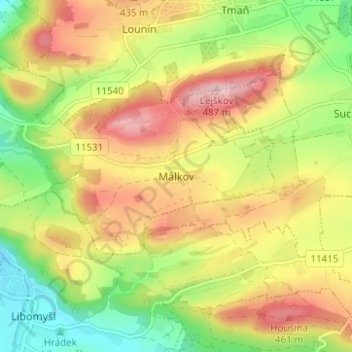
Name: Málkov topographic map, elevation, terrain.
Location: Málkov, okres Beroun, Central Bohemia, 26721, Czechia (49.86818 14.00342 49.90818 14.04342)
Average elevation: 375 m
Minimum elevation: 276 m
Maximum elevation: 477 m
Thank you for supporting this site ❤️
Make a donation
Make a donation
Gear up for your next adventure:
As an Amazon Associate, this site earns from qualifying purchases at no extra cost to you.