
Thank you for supporting this site ❤️
Make a donation
Make a donation
Gear up for your next adventure:
As an Amazon Associate, this site earns from qualifying purchases at no extra cost to you.
Aurora topographic map
Click on the map to display elevation.
Thank you for supporting this site ❤️
Make a donation
Make a donation
Gear up for your next adventure:
As an Amazon Associate, this site earns from qualifying purchases at no extra cost to you.
About this map
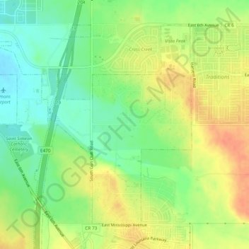
Name: Aurora topographic map, elevation, terrain.
Location: Aurora, Arapahoe County, Colorado, 80018, United States (39.69655 -104.74423 39.72557 -104.69720)
Average elevation: 1,699 m
Minimum elevation: 1,678 m
Maximum elevation: 1,720 m
Thank you for supporting this site ❤️
Make a donation
Make a donation
Gear up for your next adventure:
As an Amazon Associate, this site earns from qualifying purchases at no extra cost to you.