Geolocate

Olney topographic map

Click on the map to display elevation.

About this map
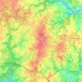
Name: Olney topographic map, elevation, terrain.

Location: Olney, Montgomery County, Maryland, United States (39.10895 -77.11047 39.18515 -77.02751)

Average elevation: 136 m

Minimum elevation: 90 m

Maximum elevation: 175 m

Other topographic maps

Click on a map to view its topography, its elevation and its terrain.

Anscroft

United States > Maryland > Montgomery County > Olney

Average elevation: 138 m

Gear up for your next adventure:

🔋Solar Power Banks - Keep your GPS and phone charged during multi-day expeditions
🪓Outdoor Multitools - Versatile tools for hiking and camping
🌦️Portable Weather Meters - Handheld tools for monitoring weather conditions
🔋Solar Chargers - Eco-friendly charging solutions for outdoor use
📚UK Hiking Guidebooks - Detailed route descriptions for the Lake District, Peaks, and Highlands

As an Amazon Associate, this site earns from qualifying purchases at no extra cost to you.