Geolocate

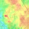
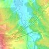
Peninsula topographic map

Click on the map to display elevation.

About this map
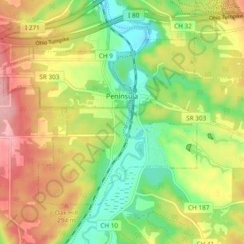
Name: Peninsula topographic map, elevation, terrain.

Location: Peninsula, Summit County, Ohio, 44264, United States (41.21916 -81.58454 41.25266 -81.51891)

Average elevation: 259 m

Minimum elevation: 198 m

Maximum elevation: 329 m

Other topographic maps

Click on a map to view its topography, its elevation and its terrain.
Boston

United States > Ohio > Summit County

Average elevation: 245 m

Greensburg

United States > Ohio > Summit County > Green

Average elevation: 358 m

Six Corners

United States > Ohio > Summit County > Tallmadge

Average elevation: 350 m

Metz

United States > Ohio > Summit County > Stow

Average elevation: 318 m

Copley

United States > Ohio > Summit County

Average elevation: 318 m

North Springfield

United States > Ohio > Summit County > Akron

Average elevation: 336 m

Copley

United States > Ohio > Summit County

Average elevation: 318 m

Copley

United States > Ohio > Summit County

Average elevation: 318 m

Sagamore Hills

United States > Ohio > Summit County

Average elevation: 264 m

Maple Grove Park

United States > Ohio > Summit County > Hudson

Average elevation: 316 m

Gear up for your next adventure:

🥾Hiking Boot Waterproofing Wax - Maintain the lifespan of your leather trekking boots
🧴Tick Removal Tools - Small, essential health tool for UK woodland and moorland
👖Packable Overtrousers - Quick-deploy rain protection for legs in sudden storms
💧Hydration Reservoirs - Convenient water bladders for hands-free drinking on the move
🎒Hiking Daypacks - Compact backpacks ideal for short hikes and excursions

As an Amazon Associate, this site earns from qualifying purchases at no extra cost to you.