Geolocate

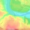
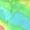
Montgomery topographic map

Click on the map to display elevation.

About this map

Name: Montgomery topographic map, elevation, terrain.

Location: Montgomery, Calgary, Alberta, Canada (51.06066 -114.17903 51.08148 -114.14781)

Average elevation: 1,102 m

Minimum elevation: 1,053 m

Maximum elevation: 1,233 m

Other topographic maps

Click on a map to view its topography, its elevation and its terrain.
Nose Hill Park

Canada > Alberta > Calgary

Names currently associated with topographical features in and near Nose Hill Park reflect the impact of the European newcomers and European trade goods on the Peigan. For example, Spy Hill, the westward extension of Nose Hill, derived its present name from the aboriginal practice of communicating with distant…

Average elevation: 1,174 m
Calgary

Canada > Alberta > Calgary

Average elevation: 1,106 m

Grasshopper Hill

Canada > Alberta > Calgary

Average elevation: 1,076 m

Confederation Park

Canada > Alberta > Calgary

Average elevation: 1,090 m

Glenmore Reservoir

Canada > Alberta > Calgary

Average elevation: 1,085 m

Bearspaw Dam

Canada > Alberta > Calgary

Average elevation: 1,137 m

Dale Hodges Park

Canada > Alberta > Calgary

Average elevation: 1,092 m

Elbow River

Canada > Alberta > Calgary

Average elevation: 1,100 m

Edworthy Park

Canada > Alberta > Calgary

Average elevation: 1,129 m

Riley Park

Canada > Alberta > Calgary

Average elevation: 1,069 m

River Park

Canada > Alberta > Calgary

Average elevation: 1,086 m

Central Memorial Park

Canada > Alberta > Calgary

Average elevation: 1,056 m

Vermillion Hill Storm Pond Park

Canada > Alberta > Calgary

Average elevation: 1,133 m

Savanna Park

Canada > Alberta > Calgary

Average elevation: 1,095 m

Gear up for your next adventure:

⌚Altimeter Watches - Watches measuring altitude for mountain activities
👖Convertible Hiking Trousers - Versatile zip-off pants for changing mountain weather conditions
🔋Solar Power Banks - Keep your GPS and phone charged during multi-day expeditions
🧊Personal Water Filters - Drink safely from mountain streams marked on your map
🧘Folding Sit Mats - Dry and warm seat for map-reading breaks on damp ground

As an Amazon Associate, this site earns from qualifying purchases at no extra cost to you.