
Óbarok topographic map
Interactive map
Click on the map to display elevation.
About this map
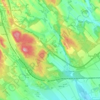
Name: Óbarok topographic map, elevation, terrain.
Average elevation: 214 m
Minimum elevation: 138 m
Maximum elevation: 364 m
Other topographic maps
Click on a map to view its topography, its elevation and its terrain.
Nagyegyháza
Hungary > Fejér > Óbarok > Nagyegyháza
Nagyegyháza, Óbarok, Bicskei járás, Fejér, Central Transdanubia, Transdanubia, 2063, Hungary
Average elevation: 231 m