
St. Felix - San Felice topographic map
Interactive map
Click on the map to display elevation.
About this map
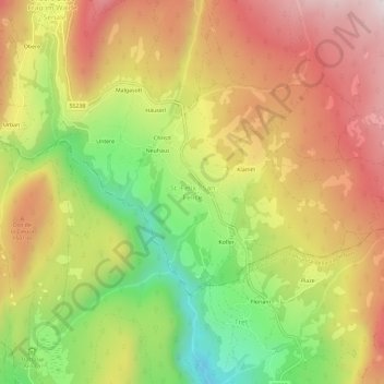
Name: St. Felix - San Felice topographic map, elevation, terrain.
Average elevation: 1,354 m
Minimum elevation: 968 m
Maximum elevation: 1,697 m