
Hellín topographic map
Interactive map
Click on the map to display elevation.
About this map
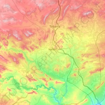
Name: Hellín topographic map, elevation, terrain.
Location: Hellín, Albacete, Castilië-La Mancha, 02400, Spanje (38.30874 -1.87625 38.68929 -1.47489)
Average elevation: 604 m
Minimum elevation: 276 m
Maximum elevation: 1,040 m