
Great Rift Valley topographic map
Click on the map to display elevation.
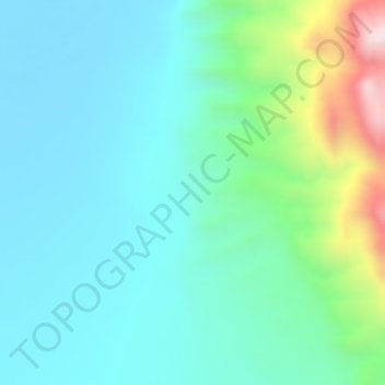
About this map
Name: Great Rift Valley topographic map, elevation, terrain.
Location: Great Rift Valley, Borena, Oromia Region, Ethiopia (4.99995 36.99995 5.00005 37.00005)
Average elevation: 631 m
Minimum elevation: 516 m
Maximum elevation: 1,008 m
Other topographic maps
Click on a map to view its topography, its elevation and its terrain.
Moyale
Moyale has a hot semi-arid climate (Köppen BSh) moderated somewhat by altitude. Typically for East Africa, there are two rainy seasons: the “long rains” from March to May and the weaker, less reliable “short rains” in October and November.
Average elevation: 1,095 m
Moyale
Moyale has a hot semi-arid climate (Köppen BSh) moderated somewhat by altitude. Typically for East Africa, there are two rainy seasons: the “long rains” from March to May and the weaker, less reliable “short rains” in October and November.
Average elevation: 1,095 m
Asela
Asella (Oromo: Asallaa, Amharic: አሰላ) is a town in central Ethiopia. Located in the Arsi Zone of the Oromia Region 126 km (78 mi) south from Addis Ababa, this town has a latitude and longitude of 7°57′N 39°7′E / 7.950°N 39.117°E / 7.950; 39.117, with an elevation of 2,430 meters. Asella…
Average elevation: 2,429 m
Lake Abaya
The only outflow of the lake is through the lower reaches of Kulfo River directly below an alluvial fan at an elevation of 1,190 m (at 6°00′39″N 37°35′07″E / 6.0109°N 37.5854°E / 6.0109; 37.5854). The riverbed acts as an spillway in the case of high lake levels and discharges the excess…
Average elevation: 1,471 m
Harena Forest
The Harenna Forest is a montane tropical evergreen forest in Ethiopia's Bale Mountains. The forest covers the southern slope of the mountains, extending from 1450 to 3200 meters elevation. The Bale Mountains are in Ethiopia's Oromia Region, and form the southwestern portion of the Ethiopian Highlands.
Average elevation: 2,028 m
Asela
Asella (Oromo: Asallaa, Amharic: አሰላ) is a town in central Ethiopia. Located in the Arsi Zone of the Oromia Region 156 km (97 mi) south from Addis Ababa, this town has a latitude and longitude of 7°57′N 39°7′E / 7.950°N 39.117°E / 7.950; 39.117, with an elevation of 2,430 meters. Asella…
Average elevation: 2,429 m