
Los Laureles topographic map
Interactive map
Click on the map to display elevation.
About this map
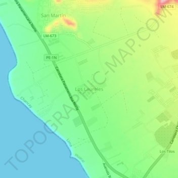
Name: Los Laureles topographic map, elevation, terrain.
Location: Los Laureles, Chancay, Province of Huaral, Lima, Peru (-11.55538 -77.29919 -11.51538 -77.25919)
Average elevation: 54 m
Minimum elevation: 0 m
Maximum elevation: 168 m
Other topographic maps
Click on a map to view its topography, its elevation and its terrain.
Humedal Santa Rosa
Humedal Santa Rosa, Chancay, Province of Huaral, Lima, Peru
Average elevation: 20 m