
Soufriere topographic map
Interactive map
Click on the map to display elevation.
About this map
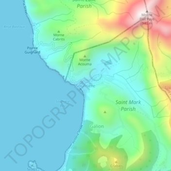
Name: Soufriere topographic map, elevation, terrain.
Location: Soufriere, Saint Mark Parish, Dominica (15.21315 -61.38037 15.25315 -61.34037)
Average elevation: 207 m
Minimum elevation: 0 m
Maximum elevation: 916 m