
Mittagskogel topographic map
Interactive map
Click on the map to display elevation.
About this map
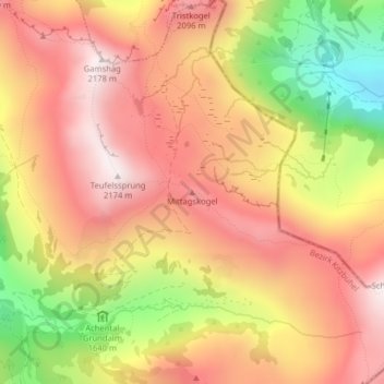
Name: Mittagskogel topographic map, elevation, terrain.
Location: Mittagskogel, Jochberg, Bezirk Kitzbühel, Austria (47.35505 12.47710 47.35515 12.47720)
Average elevation: 1,838 m
Minimum elevation: 1,362 m
Maximum elevation: 2,151 m