
อำเภอแม่สาย topographic map
Interactive map
Click on the map to display elevation.
About this map
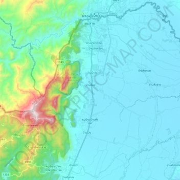
Name: อำเภอแม่สาย topographic map, elevation, terrain.
Location: อำเภอแม่สาย, เวียงพางคำ, Chiang Rai, Thailand (20.25758 99.81009 20.46483 100.03680)
Average elevation: 525 m
Minimum elevation: 365 m
Maximum elevation: 1,472 m