Geolocate

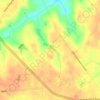
Montrose topographic map

Click on the map to display elevation.

About this map

Name: Montrose topographic map, elevation, terrain.

Location: Montrose, Laurens County, Georgia, United States (32.54381 -83.16633 32.57036 -83.13665)

Average elevation: 115 m

Minimum elevation: 101 m

Maximum elevation: 128 m

Other topographic maps

Click on a map to view its topography, its elevation and its terrain.

Lowery

United States > Georgia > Laurens County

Average elevation: 71 m

Rockledge

United States > Georgia > Laurens County

Average elevation: 71 m

Gear up for your next adventure:

👟Waterproof Leg Gaiters - Keep mud and water out of your boots in boggy terrain
🧥Packable Down Jackets - Lightweight warmth that compresses small in your bag
🧦Hiking Socks - Breathable socks designed to prevent blisters on long walks
🥾Hiking Boots - Waterproof and durable boots for long-distance hiking in the UK
👟Men's Trail Running Shoes - Lightweight grip for fast movement over topographic contours

As an Amazon Associate, this site earns from qualifying purchases at no extra cost to you.