Geolocate

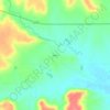
Severy topographic map

Click on the map to display elevation.

About this map

Name: Severy topographic map, elevation, terrain.

Location: Severy, Greenwood County, Kansas, 67137, United States (37.61526 -96.23432 37.62805 -96.22048)

Average elevation: 338 m

Minimum elevation: 324 m

Maximum elevation: 353 m

Other topographic maps

Click on a map to view its topography, its elevation and its terrain.

Temple Knob

United States > Kansas > Greenwood County

Average elevation: 460 m

Reece

United States > Kansas > Greenwood County

Average elevation: 378 m

Gear up for your next adventure:

🐕Hiking Dog Harnesses - Rugged harnesses for taking your companion on mountain trails
🧰First Aid Kits - Essential safety kits for outdoor activities
🥫Expedition Meals - Lightweight, high-calorie nutrition for long-distance hikers
🔭Compact Hiking Binoculars - Lightweight optics for scouting terrain and spotting wildlife
🎒Hiking Daypacks (20L) - Compact backpacks for day trips and technical mountain ascents

As an Amazon Associate, this site earns from qualifying purchases at no extra cost to you.