
Natividade topographic map
Interactive map
Click on the map to display elevation.
Natividade
The estimated population in 2020 was 9,250, the area is 3,240 km². The elevation is 323 m.
About this map
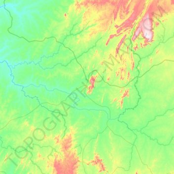
Name: Natividade topographic map, elevation, terrain.
Average elevation: 372 m
Minimum elevation: 232 m
Maximum elevation: 949 m
Other topographic maps
Click on a map to view its topography, its elevation and its terrain.