
Túquerres topographic map
Interactive map
Click on the map to display elevation.
About this map
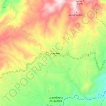
Name: Túquerres topographic map, elevation, terrain.
Location: Túquerres, Nariño, Colombia (1.04779 -77.65906 1.12779 -77.57906)
Average elevation: 3,082 m
Minimum elevation: 2,676 m
Maximum elevation: 3,538 m
Other topographic maps
Click on a map to view its topography, its elevation and its terrain.