
Borba topographic map
Interactive map
Click on the map to display elevation.
About this map
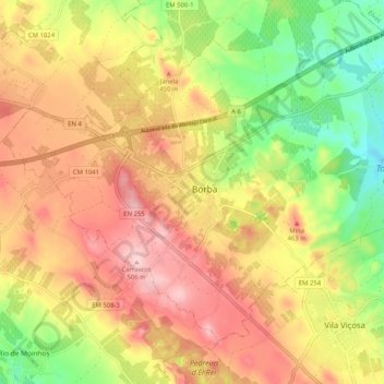
Name: Borba topographic map, elevation, terrain.
Location: Borba, São Bartolomeu, Borba, Évora, 7150-109, Portugal (38.64511 -7.61755 38.96511 -7.29755)
Average elevation: 317 m
Minimum elevation: 132 m
Maximum elevation: 654 m