Geolocate

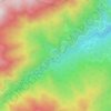
Ramsar topographic map

Click on the map to display elevation.

About this map

Name: Ramsar topographic map, elevation, terrain.

Location: Ramsar, بخش مرکزی شهرستان رامسر, Ramsar County, Mazandaran Province, Iran (36.88867 50.63290 36.95252 50.69512)

Average elevation: 90 m

Minimum elevation: -29 m

Maximum elevation: 575 m

Other topographic maps

Click on a map to view its topography, its elevation and its terrain.

Gear up for your next adventure:

🧣Fleece Neck Warmers - Extra insulation for winter topographic surveys
🦟Anti-Midge & Tick Repellent - Vital for hiking in the Scottish Highlands during summer
🍱Food Containers - Reusable containers for outdoor meals
🔋Power Banks - Portable chargers for long outdoor trips
⛺Lightweight Solo Tents - Backpacking tents designed for wild camping in the UK highlands

As an Amazon Associate, this site earns from qualifying purchases at no extra cost to you.