Geolocate

Stepney topographic map

Click on the map to display elevation.

About this map
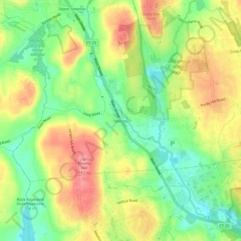
Name: Stepney topographic map, elevation, terrain.

Location: Stepney, Monroe, Greater Bridgeport Planning Region, Connecticut, 06468, United States (41.28401 -73.27403 41.32401 -73.23403)

Average elevation: 123 m

Minimum elevation: 79 m

Maximum elevation: 172 m

Other topographic maps

Click on a map to view its topography, its elevation and its terrain.

Gear up for your next adventure:

📻Hand-Crank Emergency Radios - Stay updated on weather warnings in remote areas
👖Hiking Trousers - Durable trousers designed for rough terrain
🔋Solar Power Banks - Keep your GPS and phone charged during multi-day expeditions
🧗Locking Carabiners - Secure gear to your pack or for light technical use
🌦️Portable Weather Meters - Handheld tools for monitoring weather conditions

As an Amazon Associate, this site earns from qualifying purchases at no extra cost to you.