Geolocate

Le Bez topographic map

Click on the map to display elevation.

About this map
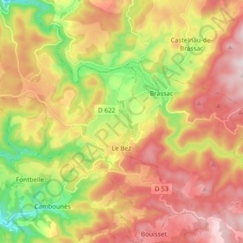
Name: Le Bez topographic map, elevation, terrain.

Location: Le Bez, Castres, Tarn, Occitania, Metropolitan France, 81260, France (43.57194 2.39838 43.66517 2.51388)

Average elevation: 625 m

Minimum elevation: 344 m

Maximum elevation: 885 m

Other topographic maps

Click on a map to view its topography, its elevation and its terrain.

Le Bez

France > Occitania > Tarn > Mirandol-Bourgnounac

Average elevation: 373 m

La Mothe

France > Occitania > Tarn > Castelnau-de-Lévis

Average elevation: 203 m

Gear up for your next adventure:

👟Waterproof Leg Gaiters - Keep mud and water out of your boots in boggy terrain
🚶Walking Pedometers - Simple distance tracking for casual trail walkers
🧊Insulated Flasks - Keeps drinks hot or cold during hikes
🔋Solar Power Banks - Keep your GPS and phone charged during multi-day expeditions
🧭Emergency Beacons - Safety beacons for remote outdoor locations

As an Amazon Associate, this site earns from qualifying purchases at no extra cost to you.