Geolocate

Bolton topographic map

Click on the map to display elevation.

About this map
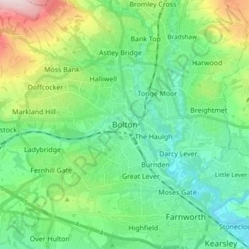
Name: Bolton topographic map, elevation, terrain.

Location: Bolton, Greater Manchester, England, BL1 1RU, United Kingdom (53.53829 -2.47004 53.61829 -2.39004)

Average elevation: 135 m

Minimum elevation: 46 m

Maximum elevation: 383 m

England trails, hiking, mountain biking, running and outdoor activities

Other topographic maps

Click on a map to view its topography, its elevation and its terrain.

Westhoughton

United Kingdom > England > Bolton > Daisy Hill

Average elevation: 97 m

Westhoughton

United Kingdom > England > Bolton > Daisy Hill

Average elevation: 97 m

Gear up for your next adventure:

⛺Lightweight Solo Tents - Backpacking tents designed for wild camping in the UK highlands
🐕Hiking Dog Harnesses - Rugged harnesses for taking your companion on mountain trails
🌂Windproof Trekking Umbrellas - Surprising but effective rain protection on low-wind trails
📐Altimeters & Barometers - Tools for measuring altitude and air pressure
🔋Lithium AA Batteries - Long-lasting power that performs well in cold mountain weather

As an Amazon Associate, this site earns from qualifying purchases at no extra cost to you.