
Stabio topographic map
Interactive map
Click on the map to display elevation.
About this map
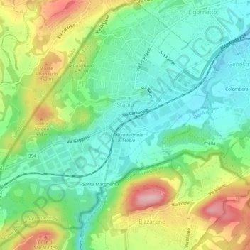
Name: Stabio topographic map, elevation, terrain.
Location: Stabio, Kreis Stabio, Bezirk Mendrisio, Tessin, Schweiz (45.83047 8.91208 45.86384 8.95550)
Average elevation: 395 m
Minimum elevation: 330 m
Maximum elevation: 515 m
Other topographic maps
Click on a map to view its topography, its elevation and its terrain.
Santa Margherita
Schweiz > Tessin > Stabio > Santa Margherita
Santa Margherita, Stabio, Kreis Stabio, Bezirk Mendrisio, Tessin, 6855, Schweiz
Average elevation: 397 m