
廣林里 topographic map
Interactive map
Click on the map to display elevation.
About this map
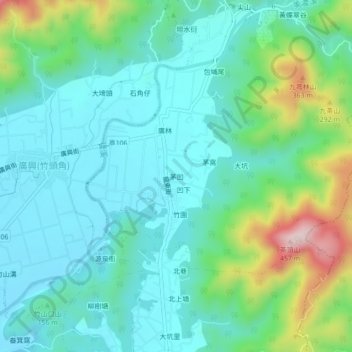
Name: 廣林里 topographic map, elevation, terrain.
Location: 廣林里, Maowa, Meinong, Kaohsiung, 843, TW (22.89435 120.56093 22.93435 120.60093)
Average elevation: 139 m
Minimum elevation: 49 m
Maximum elevation: 434 m