
Gemarang topographic map
Interactive map
Click on the map to display elevation.
About this map
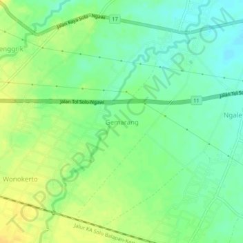
Name: Gemarang topographic map, elevation, terrain.
Location: Gemarang, Ngawi, Jatim, Indonesia (-7.43225 111.32772 -7.39225 111.36772)
Average elevation: 60 m
Minimum elevation: 48 m
Maximum elevation: 72 m