
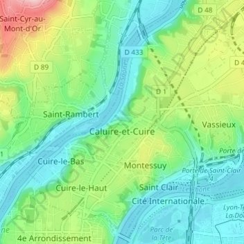
Caluire-et-Cuire topographic map
Interactive map
Click on the map to display elevation.
About this map
Name: Caluire-et-Cuire topographic map, elevation, terrain.
Average elevation: 227 m
Minimum elevation: 163 m
Maximum elevation: 381 m
Other topographic maps
Click on a map to view its topography, its elevation and its terrain.
Parc de la Tête d'Or
France > Auvergne-Rhône-Alpes > Métropole de Lyon > Lyon
Average elevation: 189 m
Parc Sergent Blandan
France > Auvergne-Rhône-Alpes > Métropole de Lyon > Lyon
Average elevation: 174 m
Les Aqueducs de Champvert
France > Auvergne-Rhône-Alpes > Métropole de Lyon > Lyon
Average elevation: 236 m
Island
France > Auvergne-Rhône-Alpes > Métropole de Lyon > Collonges-au-Mont-d'Or
Average elevation: 218 m