
Reil topographic map
Interactive map
Click on the map to display elevation.
About this map
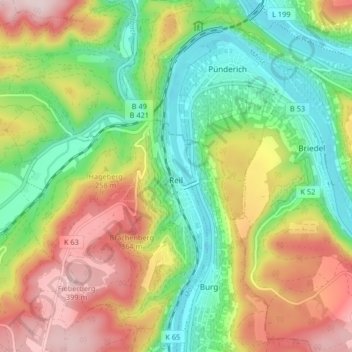
Name: Reil topographic map, elevation, terrain.
Average elevation: 226 m
Minimum elevation: 85 m
Maximum elevation: 417 m
Other topographic maps
Click on a map to view its topography, its elevation and its terrain.
Hilscheid
Germany > Rhineland-Palatinate > Landkreis Bernkastel-Wittlich
Hilscheid, Thalfang am Erbeskopf, Landkreis Bernkastel-Wittlich, Rhineland-Palatinate, Germany
Average elevation: 526 m