
Houthulst topographic map
Interactive map
Click on the map to display elevation.
About this map
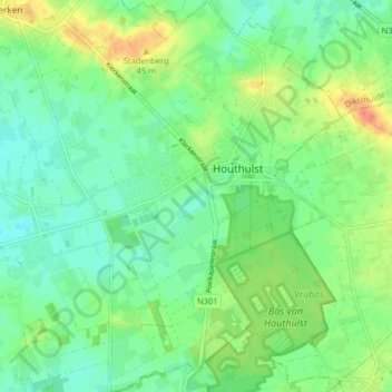
Name: Houthulst topographic map, elevation, terrain.
Location: Houthulst, Dixmude, Flandre-Occidentale, Belgique (50.94853 2.92193 50.99925 2.97371)
Average elevation: 19 m
Minimum elevation: 4 m
Maximum elevation: 46 m