
Ōsaka topographic map
Interactive map
Click on the map to display elevation.
About this map
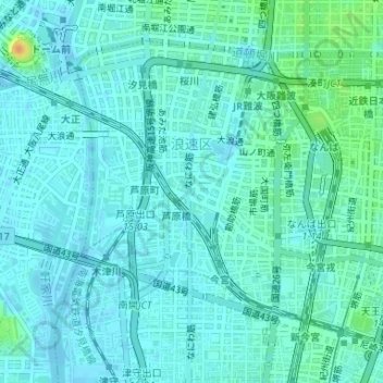
Name: Ōsaka topographic map, elevation, terrain.
Location: 浪速区, Ōsaka, Préfecture d'Osaka, Kansaï, Japon (34.64868 135.48054 34.67001 135.51087)
Average elevation: 7 m
Minimum elevation: -1 m
Maximum elevation: 33 m
Other topographic maps
Click on a map to view its topography, its elevation and its terrain.