
Haveringland topographic map
Interactive map
Click on the map to display elevation.
About this map
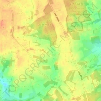
Name: Haveringland topographic map, elevation, terrain.
Location: Haveringland, Broadland, Norfolk, England, United Kingdom (52.71836 1.17627 52.75911 1.21866)
Average elevation: 35 m
Minimum elevation: 14 m
Maximum elevation: 49 m
Norfolk trails, hiking, mountain biking, running and outdoor activities
Other topographic maps
Click on a map to view its topography, its elevation and its terrain.
Haveringland Lake
United Kingdom > England > Norfolk > Broadland > Haveringland
Average elevation: 39 m
Great Witchingham Village Hall Park
United Kingdom > England > Norfolk > Broadland > Lenwade > Great Witchingham
Average elevation: 26 m
Blofield Heath
United Kingdom > England > Norfolk > Broadland > Blofield Heath
Average elevation: 20 m